Key Features:
- Automatically Records Geodata
- Use as Geologger
- Built-in Digital Compass
- Time Synchronisation
- Hot Shoe or USB Connection
- Powered by AA Battery
- Lightweight and Durable
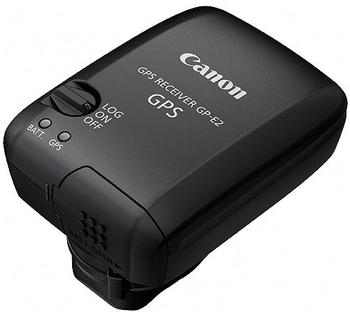
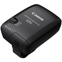
Canon GP-E2 External GPS Unit for EOS

Australian Owned, Online Since 2001

Local Contact Centre

Industry Experts, Knowledgeable Team

Australia Wide Delivery

From Beginner to Pro, Affordable Gear
Secure Payment Methods
-
 Direct Deposit
-
 PayPal Express
-
 American Express
-
 MasterCard
-
 Visa
Visa
Key Features:
- Automatically Records Geodata
- Use as Geologger
- Built-in Digital Compass
- Time Synchronisation
- Hot Shoe or USB Connection
- Powered by AA Battery
- Lightweight and Durable
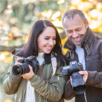
The Canon GP-E2 External GPS Unit is a rugged and compact, high-sensitivity, high-precision GPS module for ascertaining current latitude, longitude and elevation and automatically geotagging image metadata when used with the latest Canon DSLR cameras. The built-in GPS logger can also be used with all EOS digital cameras as a standalone device for manually geotagging images. A Built-in digital compass allows adding of shooting direction data to images’ location on a map. The unit also features a Time Synchronization function that updates the time setting in the camera.
Compatible with the following Canon EOS DSLR cameras
7D^† / 5D Mark III^ / 1DX
^The EOS 5D Mark III and EOS 7D require a firmware upgrade to be compatible with the GPS Receiver GP-E2, which will be available soon.
†When the EOS 7D is used with the GP-E2 the following restrictions will apply: a) geotagging function will not work for movies while recording; b) geotagging features will not work for movies when using the Map Utility; c) electronic compass information and automatic time setting is not available; d) transmission via the hot shoe is not possible. USB cable connection must be used.
Barcode (UPC / EAN): 4960999848358
|
TYPE |
|
|
Type |
GPS receiver |
|
GPS |
|
|
Location information Self contained navigation |
Latitude, longitude, altitude, and time (UTC) |
|
Digital Compass |
|
|
Type Direction positioning interval |
Direction calculated using a triaxial geomagnetic sensor and triaxial |
|
Logging |
|
|
Logging interval |
Every 1, 5, 10, 15, or 30 seconds, or every 1, 2, or 5 minutes |
|
GPS Modes |
|
|
Power switch set to
Connected to a computer |
Location information (latitude, longitude, altitude, direction, and UTC time) is automatically added to images Exif information when taking pictures. |
|
Time adjustment |
|
|
Type |
Set GPS time data on the camera [4][2] |
|
Interface |
|
|
Hotshoe |
For direct camera connection |
|
POWER SUPPLY |
|
|
Power supply Battery check |
Off/On/Logging |
|
PHYSICAL SPECIFICATIONS |
|
|
Colour |
Black |
|
RELATED PRODUCTS |
|
|
Accessories |
Storage case, Interface cables, Soft case, Map Utility |
All data is based on Canon standard testing methods except where indicated
Subject to change without notice
[1] L1 band: Frequency allocated for civilian use. Other frequencies include the L2 band (military use) and L5 band (highprecision civilian use)
[2] Not compatible with EOS 7D even with firmware update
[3] When memory is full, older data is overwritten with new data.
[4] Requires signal acquisition from four or more satellites
[5] Margin of error relative to UTC time. High-precision time adjustment is only available for EOS-1D X
[6] Transmission via cable is used if GPS Receiver GP-E2 is attached to the hot shoe and connected by cable.
Manufacturer Warranty
This product comes with a
from Canon Australia
Want to read more about warranties?